İvanovka
İvanovka (Ивановка) is a village and municipality in the Ismailli District of Azerbaijan. It is at a height of 848 m above sea level, 13 km from Ismailli region. The municipality consists of the villages of İvanovka and Külüllü. This is the last village in Azerbaijan with a significant population belonging to the Russian ethnic religious community of Molokans. This is the last place in the world where Kolkhoz (collective farms) from Soviet times are preserved.
The village was founded in 1834 by Russian peasants, predominantly Molokans from central Russia, that had been resettled in the Caucasus by Tsar Nicholas I in the years following the Treaty of Turkmenchay at the end of the Russo-Persian War (1826–1828). Further Russian peasants migrated to the area over time. These were mostly Molokans and some Doukhobors, coming from the cities of Tambov, Voronezh, Rostov and Stavropol. In 1840, the village was named İvanovka, after the founder – Ivan Perschi.
In 1936, three cooperation of three artels joined into one collective farm. This collective farm exists even nowadays and is only working collective farm in Azerbaijan. In 1971, the leader of collective farm Nikolay Nikitin got the award of “Hero of Socialist Labor”. Under his leadership, Ivanovka's collective farm became one of the biggest in the Republic. In 1995, collective farm was renamed in name of Nikitin.
In 2005, the Molocan church was celebrating its 200th anniversary.
Map - İvanovka
Map
Country - Azerbaijan
 |
 |
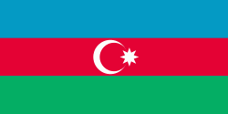
| Flag of Azerbaijan | |
The Azerbaijan Democratic Republic proclaimed its independence from the Transcaucasian Democratic Federative Republic in 1918 and became the first secular democratic Muslim-majority state. In 1920, the country was incorporated into the Soviet Union as the Azerbaijan SSR. The modern Republic of Azerbaijan proclaimed its independence on 30 August 1991, shortly before the dissolution of the Soviet Union in the same year. In September 1991, the ethnic Armenian majority of the Nagorno-Karabakh region formed the self-proclaimed Republic of Artsakh. The region and seven surrounding districts are internationally recognized as part of Azerbaijan pending a solution to the status of the Nagorno-Karabakh through negotiations facilitated by the OSCE, although became de facto independent with the end of the First Nagorno-Karabakh War in 1994. Following the Second Nagorno-Karabakh War in 2020, the seven districts and parts of Nagorno-Karabakh were returned to Azerbaijani control.
Currency / Language
| ISO | Currency | Symbol | Significant figures |
|---|---|---|---|
| AZN | Azerbaijani manat | ₼ | 2 |
| ISO | Language |
|---|---|
| HY | Armenian language |
| AZ | Azerbaijani language |
| RU | Russian language |


